Every perfect wave begins far from shore — not in the lineup, but deep in the open ocean where wind, pressure, and motion work together in one of nature’s most fascinating dances. For surfers, understanding how storm systems generate swell isn’t just science — it’s the key to predicting those magic sessions when the ocean comes alive.
This is the story of how storms thousands of miles away create the lines of energy that transform into the surf we chase.
The Birth of a Wave: Energy Meets Wind
All waves begin as energy transferred from the wind to the ocean’s surface. When strong winds blow across vast stretches of open sea — known as the fetch — they push against the water, creating ripples that grow into rolling waves.
The stronger the wind and the longer it blows across the water, the more energy is transferred. This combination of wind speed, duration, and fetch determines the size, power, and travel distance of the swell.
Think of it like painting a masterpiece — the ocean is the canvas, and the wind is the brush. The longer the brush moves, the bigger and more organized the artwork becomes.
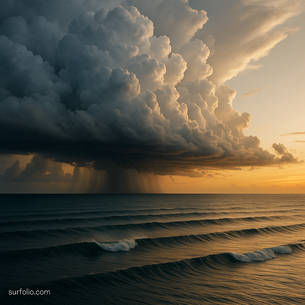
The Role of Storm Systems
At the heart of every major swell lies a storm system, often thousands of miles offshore. These systems are usually low-pressure zones, where rising warm air and converging winds create intense movement in the atmosphere.
As the pressure drops, the surrounding air rushes in, generating powerful winds that whip across the ocean surface. The strongest of these systems — like North Pacific winter storms or Southern Ocean lows — are responsible for producing the long, organized swells that travel across entire oceans.
Types of storm systems that create swells:
- Extratropical cyclones: Common in colder regions, responsible for most long-period groundswells.
- Tropical cyclones and hurricanes: Generate powerful but more localized swells, often producing shorter but intense bursts of surf.
- Monsoonal systems: Create seasonal consistency in regions like Indonesia and Sri Lanka.
Each has its own signature, influencing not just wave size but also direction, period, and shape.
From Wind Chop to Groundswells
When a storm first forms, its chaotic winds create wind chop — short, messy waves close to the storm’s center. But as the storm stabilizes and moves, these waves begin to organize into swell trains, traveling outward in clean, rhythmic lines.
Over time, friction and distance filter the chaos — short-period waves die off, while long-period waves (with more energy) continue to travel.
These long-period waves become what surfers know as groundswells — powerful, well-formed, and capable of maintaining energy over thousands of miles.
Key differences:
- Wind Swell: Generated by local winds, choppy, short-period (4–8 seconds).
- Groundswell: Generated by distant storms, smooth, long-period (12–20+ seconds).
Groundswells are the ones surfers dream about — the clean, corduroy lines that light up reefs and points when they finally hit land.
Measuring Swell Energy
Swell energy is measured in wave period (the time between wave crests). This number is crucial because it determines how much power a wave carries.
- Short period (5–8 seconds): Local winds, weak surf.
- Medium period (9–12 seconds): Consistent, moderate energy.
- Long period (13–20+ seconds): Distant storms, heavy power, and deep penetration.
A 6-foot swell with a 16-second period can produce waves significantly larger than a 6-foot swell with an 8-second period. The longer period means the energy runs deeper and travels faster, creating those thick, pushing waves that make your board hum beneath your feet.
Swell Direction and Travel
Once formed, swells radiate outward from their storm source in all directions, similar to ripples from a stone dropped in water.
However, only the portion of that swell traveling toward your coast will eventually produce surfable waves. This is where swell direction comes into play.
Each surf break works best with a certain swell angle depending on coastline orientation, reefs, and ocean floor contours.
Examples:
- Hawaii’s North Shore: Best with swells from North Pacific winter storms.
- California: Relies on WNW or SW swells depending on season.
- Indonesia: Lights up during long-period SW groundswells from Antarctic storms.
Understanding where a swell originates helps predict when and where your local waves will fire.
The Ocean’s Filter: Bathymetry and Refraction
As swells approach shallow coastal zones, they interact with the ocean floor — a process that shapes the final quality of the surf.
This underwater topography, or bathymetry, refracts and bends wave energy, focusing it on reefs and points or dispersing it across sandy beaches.
- Reef breaks create consistent, perfectly peeling waves because the ocean floor is stable and shaped like a ramp.
- Beach breaks constantly shift due to sand movement, changing how swells break.
- Point breaks allow waves to wrap and peel over long distances, creating long rides.
So while storms create the energy, it’s the coastline’s shape that decides how it’s expressed. That’s why surfers obsess over both global storm maps and local sandbars — both matter equally.
Storm Seasons Around the World
Different oceans have unique swell-producing patterns depending on the time of year:
- North Pacific: Winter low-pressure systems send consistent swells to Hawaii and the U.S. West Coast (November–March).
- South Pacific: Autumn and winter storms fuel classic Indo and South American surf (April–September).
- Atlantic Ocean: Hurricane season (June–November) creates short-lived but powerful east coast swells.
- Indian Ocean: The Southern Ocean’s powerful lows deliver steady swells to Indonesia and the Maldives.
Each hemisphere has its window — when the storm belts align, and energy begins its journey toward distant shores.
Satellite Swell Tracking and Forecasting
Modern surfers have a massive advantage: technology. Satellites and ocean buoys now track storm systems in real time, measuring wind speeds, pressure changes, and swell movement.
Websites like Surfline, Magicseaweed, and Windy use this data to model how energy will arrive at coastlines days in advance.
Key data points to watch:
- Swell height and period.
- Swell direction.
- Wind conditions (onshore vs offshore).
- Tide timing for your local break.
Reading these numbers becomes second nature — like decoding the ocean’s heartbeat before paddling out.
From Storm to Shore: The Surfer’s Payoff
When all the elements align — a deep low-pressure storm, long fetch, perfect direction, and favorable local winds — something magical happens. Thousands of miles from the storm that birthed it, that same energy transforms into a clean, glassy wall of water beneath your feet.
That’s what makes surfing so addictive: every ride is powered by a force born in chaos but refined by time and distance.
Each wave carries a story that began with the wind’s whisper across an open sea — a journey that ends in a single, fleeting, perfect moment of glide.
Final Thoughts
Storms may be chaotic, but to surfers, they’re poetry in motion. They remind us how deeply interconnected nature’s forces are — how weather systems on one side of the planet can shape the joy of a surfer on the other.
Understanding the science of swell generation isn’t about memorizing data — it’s about appreciating the vast journey that brings each wave to life. So next time you’re out in the lineup, take a second to look toward the horizon and remember: every wave began as wind, transformed by distance, and delivered as pure energy from the heart of the storm.